
See Crises Before They Reach You
↳
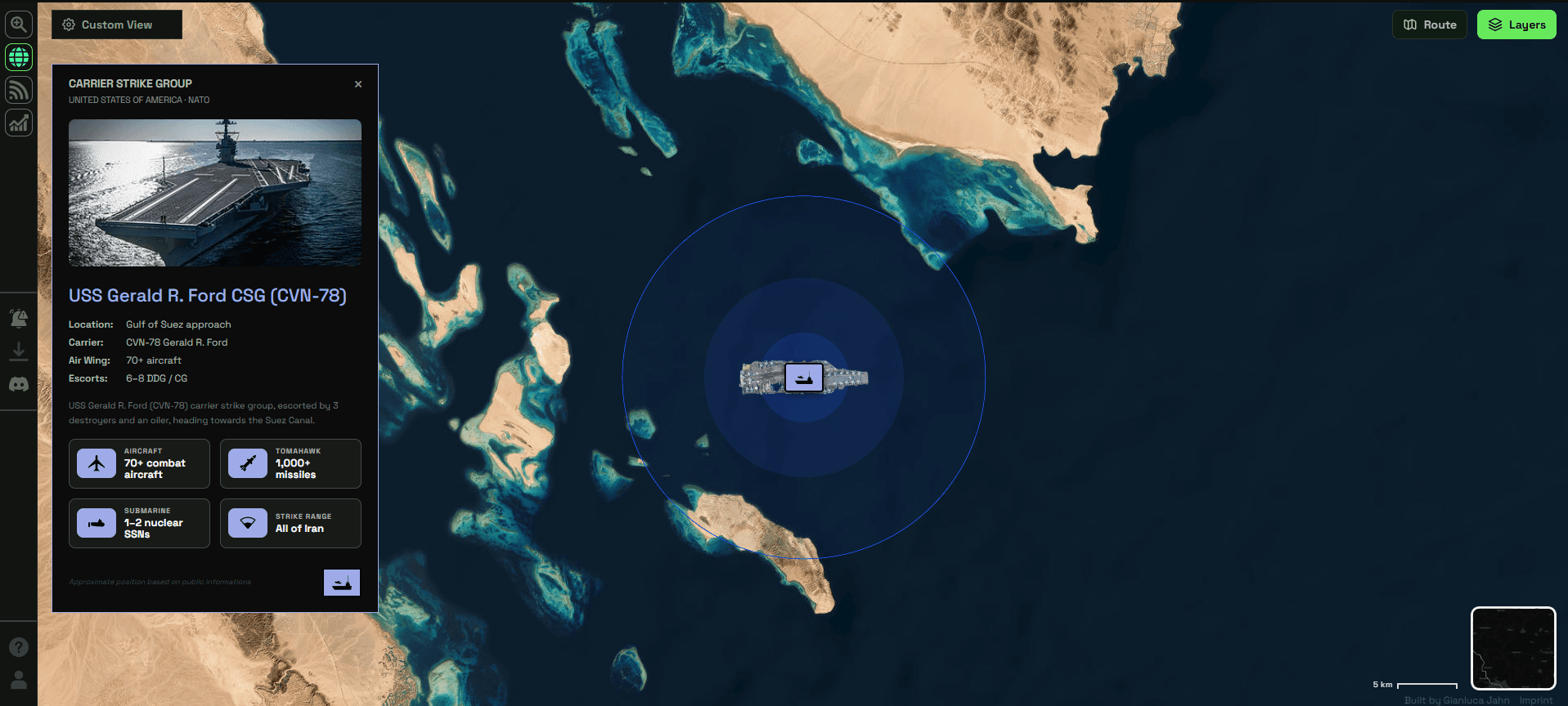
Argos Radar is a real-time intelligence terminal tracking 25+ live layers across active crisis zones .
Our Focus
Argos Radar turns active crisis regions into readable intelligence: combining live threat zones, infrastructure, movement data, and safe-route logic in one operational map.
argos radar
A readable map for unstable regions.

Features


How radar works
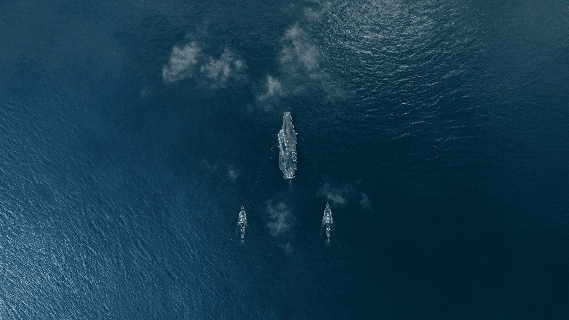
Live Crisis Layer
Track active danger zones, incidents, military activity and other evolving signals across unstable regions.
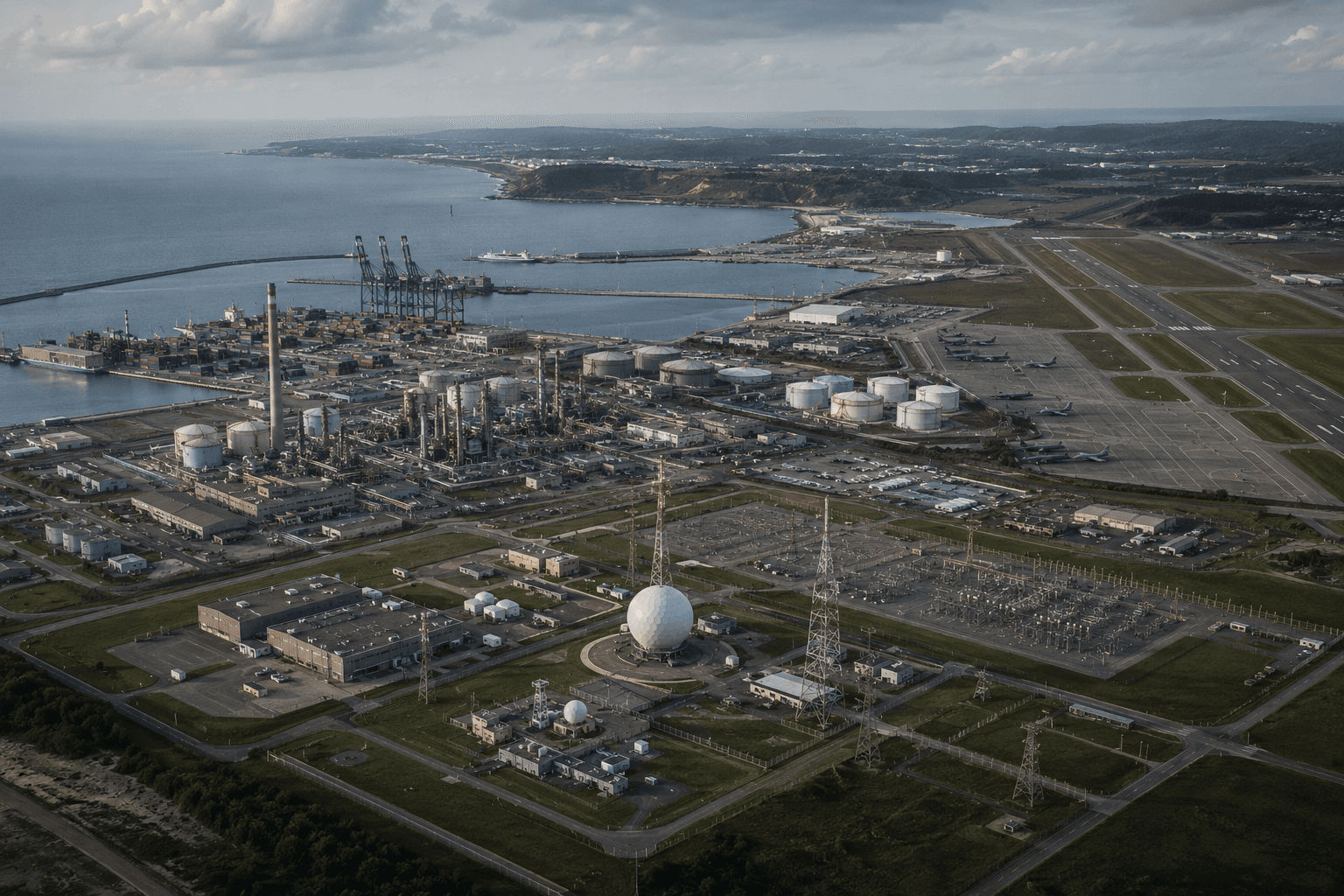
Critical Infrastructure
See airports, ports, power grids, energy sites, hospitals and embassies in relation to developing events.
Safe Route Guidance
Identify safer paths around active risk areas with route logic designed for fast-moving crisis environments.
THREAT ZONES
REGIONAL THREAT MONITORING
STRATEGIC ASSET TRACKING
CRITICAL INFRASTRUCTURE

OPERATIONAL VIEW
One map for active crisis regions.
Radar turns complex environments into readable intelligence by combining live incidents, threat zones, infrastructure, movement data and route awareness inside one map-based interface.

REAL-TIME CONTEXT
See what matters, where it matters.
Monitor aircraft, ships, borders, energy sites, hospitals, embassies and danger areas as the situation changes. Radar gives users the context they need to understand risk before it reaches them.

Free · Open Beta · No Signup
